OWLL

First Landing Prototype

A proposed six-week place-based learning journey exploring how water shapes land, life, history, and the future of Virginia Beach.

How does water shape land, life, history, and the future of Virginia Beach?

Water Shapes the Journey
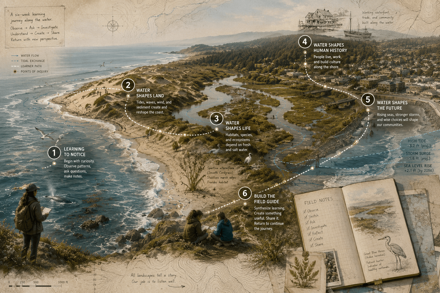
Conceptual field-atlas plate showing a six-week coastal learning journey across shoreline, dunes, wetlands, human history, coastal risk, and learner synthesis.

Educational premise

First Landing and the surrounding coastal environment can function as a living systems classroom. A six-week journey moves learners from observation to inquiry to creation, using the place itself as the primary text.

Six-week learner arc

Accessible summary of the journey shown in the field plate above. Provisional public sketch — not a finalized curriculum.

  1. Week 1: Learning to Notice. Shoreline observation. Establish bearings; distinguish noticing from explanation.
  2. Week 2: Water Shapes Land. Geology & erosion. Investigate sediment, elevation, and changing coastal forms.
  3. Week 3: Water Shapes Life. Estuary & habitat. Explore adaptation, biodiversity, and living systems.
  4. Week 4: Water Shapes Human History. Settlement & culture. Connect waterways to travel, labor, and Virginia Beach history.
  5. Week 5: Water Shapes the Future. Stewardship & policy. Investigate flooding, resilience, and public decisions.
  6. Week 6: Build the Field Guide. Synthesis & creation. Synthesize observations into a learner-created artifact.

Illustrative observation record

Illustrative specimen — not actual learner data. Shown to demonstrate how a Field Note might move through inquiry.

The waterline appears higher on one side of the path.

Is the difference caused by tide, elevation, wind, drainage, or something else?

Time
Tuesday, 9:14 a.m.
Location
North trail bend, approximate
Sketch
Field sketch placeholder
Weather
Light wind from the east; overcast
Measurement
Relative height noted; no instrument

What evidence would help you distinguish between a temporary condition and a persistent pattern?

Sample explanation: the difference may reflect tidal timing combined with slight elevation change along the path. Further observation at different times would help confirm.

Annotated field-guide entry comparing waterline marks across visits.

On returning, the learner might notice whether the pattern holds at low tide, after rain, or during different wind conditions.

Intended outputs

  • Field Notes
  • Place-based questions
  • Evidence collection
  • Maps
  • Explanations
  • Mentor conversations
  • A learner-created field guide
  • Reflection on how perception changed

What the pilot is intended to test

  1. Whether a real place can sustain a coherent multidisciplinary learning journey
  2. Whether observation can lead naturally into rigorous inquiry
  3. How much structure learners require
  4. How mentors should support progress
  5. Which Field Notes are useful
  6. What should be automated
  7. What requires human judgment
  8. What evidence demonstrates meaningful learning
  9. How a six-week journey could lead into future local journeys

What currently exists

A public design sketch, learner arc outline, and pilot inquiry framework. Curriculum materials, partnerships, safety plans, and learner-support models remain in development.

What remains future work

Facilitator guides, detailed session plans, partnership agreements, safeguarding procedures, Field Notes tooling integration, and pilot evaluation methods.

What kind of conversation is appropriate now

OWLL is interested in thoughtful conversations about potential pilot environments, curriculum design, mentorship models, and community partnerships — not enrollment applications.